30 December 2012

The Great Outdoors


When I was a child, my grandfather told stories of what happened to naughty children.  “A great big hoot owl will swoop down from the top of the big old pine tree, and he’ll snatch you up in his great claws and carry you way up to his nest at the top of the tree.  He’ll settle you down next to all the other lil’ baby hoot owls and feed you worms.  And we’ll never find you, ‘cause you can scream and scream but that ol’ hoot owl will just think you’re hungry, and keep fillin’ your beak with worms ‘til one day, you’ll turn into a hoot owl.”  This story was immeasurably improved by his raspy delivery on the porch at nighttime, creaking in the metal rocker.  We were protected from this fate, and by all of the unknown creatures of the Mississippi nightwoods, by only a thin mesh of wire screening, a few sticks of wood frame.  It gave my little sister and I chills, and while we visited, we were very, very good.

The terrors of being left outside at night were real to us, having experienced the feeling, although often at close range to safety.  But not many children today get as close to nature as we did in those southern summers, playing in the barn, the lake, the field; only excluded from the limits of my grandmother’s garden.  Children certainly aren’t permitted out alone, at night, beyond the safety of their backyard, if even there.  The majority of children are supervised when they play; 52% are supervised even in the garden. In natural places, this rises to over 80%, even in daytime.

The forest we feared gave us turpentine, lumber, and paper.  It also gave my grandfather and uncles a living, with jobs in the sawmill, construction, boatbuilding, farming and timber; it bestowed a subsistence through deer and turkey and pecans in the fall, figs and berries in the summer, and firewood all year round.  Fear of the forest recedes with familiarity, but this also inspires new concerns for what may be lost with the forest: for children, this includes a sense of capability and independence.  For medicine, the possibility of new cures from endangered species, and a weapon in the fight against obesity and diabetes.  For ecological balance, the essential predators and top-level species that check the population of prey and invasive species that can explode without their vigilance.  And for the climate, the carbon sequestration that is necessary to mitigate climate change.

To suggest that architecture has a role in encouraging people to spend more time outdoors seems counterintuitive.  And yet, good design can encourage interaction between inside and outside.  A trellis brings nature close for sensory pleasure; a glasshouse is one step toward a garden; a window an invitation to step beyond the frame.  Without architecture, the “great outdoors” becomes a threat.  In cooperation, the outside becomes a respite, a relief necessary for our mental health and regeneration.

What time is spent indoors should also promote health.  In the United States, this is 87% of our lives – about 69% within our residences, and 18% in work, school, or leisure.  Statistics in other countries are not wildly different.  With such a radical inversion in the location of human activity over the last two centuries, indoor air quality becomes much more important.  Architecture continues to pursue improvements such as reducing volatile organic compounds, and improving particle filtration, so as to reduce allergies and asthma for occupants.

Without nature, the real and unexpected, the living and unpredictable, shall we enjoy only conservatories filled with artifice, and survive like the characters of science fiction, with our only nature a covered roof garden populated with mechanized animals? Architecture preserves natural habitats through wise resource use, reclamation, rapidly renewable materials, and efficient structures.  And if, as work and school and media become less aligned with the circadian rhythms as also predicted in sci-fi, the artifice of aural and visual stimulation will do little to fulfill our sensory needs.  Nature, even at nighttime, supplies the experience of wind, the sounds of water’s movement, the call of birds and the rustle of leaves.

As cities become more dense, wild lands must be preserved through conservation.  Increasingly small patches of nature must rally to fight air pollution, and promote exercise, to counteract obesity and diseases such as diabetes.  The result of access to nature is not only the restoration of nature, but a human renaissance as well.

As schools become more protective of their students, will children forever lose recess outdoors, and be confined to gymnasia and lunch halls?  If lessons from the best school system in the world are taken to heart, the answer will be a resounding “No.”  Finland has the fewest class hours of any educational system in the developed world, yet maintains the highest scores in science and reading.  Elementary students get 75 minutes of recess each day, compared to 27 minutes in the United States.  A reporter for The New Republic writes, “While observing recess outside the Kallahti Comprehensive School on the eastern edge of Helsinki on a chilly day in April 2009, I asked Principal Timo Heikkinen if students go out when it’s very cold. Heikkinen said they do. I then asked Heikkinen if they go out when it’s very, very cold. Heikkinen smiled and said, ‘If minus 15 [Celsius] and windy, maybe not, but otherwise, yes. The children can’t learn if they don’t play. The children must play.’”

In rain and sunshine, nature provides essential human needs; in cold and wind it challenges our survival.  Architecture developed strategies to resist these threats, perhaps too well.  Now, the challenge is to create buildings without air infiltration which invite the breezes, structures immobile against floods which can later be moved to safer elevations, spaces immune to the sun’s daily heat gain but retain views of nature and the city surrounding us.  Nature deficit is not limited to the Western World, and is even noted in cities such as Addis Ababa, Ethiopia.  It is time for children to return to the wild, for architecture to halt the march across unspoiled land, and for designers to create a new interaction between building and the world outside. These measures will ensure not only the potential for ecological balance, but also that tales of the dark and spooky forest are not confined to the past.


References:
Report to Natural England on Childhood and Nature: a Survey on Changing Relationships with Nature Across Generations: http://www.naturalengland.org.uk/Images/Childhood%20and%20Nature%20Survey_tcm6-10515.pdf
Samuel E. Abrams, “The Children Must Play.”  The New Republic, January 28, 2011.

14 December 2012

Asphalt versus Concrete


Asphalt is unfitted to creating paths in coastal environments.  When storms rise and cover the pavement’s surface, the material breaks up into small chunks which are difficult to recover, and these can remain along the shoreline for years, breaking down into petrochemical products that continue to impact the water quality. 

This is very different from concrete paths and roadways, which admittedly require greater input of resources, but typically last longer.  The initial cost difference is about 135-150% of asphalt, but the expected life is 27.5 years, instead of asphalt’s 15.5 year life.  Both surface materials require proper sub-base beds to support anticipated loads.  Concrete maintains integrity under much greater loads, with higher traffic rates and lower maintenance.  When concrete breaks down, it is inert and recyclable.

Northern climates use asphalt because it is more flexible in cold weather, and less likely to be damaged by frost heaving or salt deposits from anti-snow measures.  In the South, the additional heat reflected by the black asphalt causes objects to sink into the pools of hot tar.  Concrete is a cooler material, reflecting sunlight rather than absorbing it, and lowering temperatures on top and surrounding it.

We are devoted to reducing ocean pollution and marine debris from storms and other sources.  The installation of roads and buildings should contribute as little as possible to marine damage.  Asphalt is not a good solution to creating roads, trails, and driveways in fragile coastal environments; concrete and permeable pavements are preferred solutions for access.

06 December 2012

Edges to Urban Growth


Ebenezer Howard didn’t start the craze, he only picked up where the ancient Greek concept of natural limits to growth lay abandoned in the ruins of the agora. In the 2000 years since the explosive growth of Athens’ civilization, the normal moderators of population growth – plague, fire, food – ensured that population numbers remained in balance. But by the early twentieth century, the industrial revolution, plus the evolution of the medical and agricultural fields resulted in intense development pressures from overcrowded cities, which could only build up… or out.

The ancient Greek city could not be too far removed from the rural areas and Dionysian pleasures. Aristotle’s Lesson of Controlled Growth, with established natural limits. “What we have said concerning a city… is sufficient in itself to furnish what will make the inhabitants happy; for which purpose it must be able to supply them with all the necessaries of life; for it is the having these in plenty, without any want, which makes them content.”

Howard designed the Garden City for an ideal population of 32,000 people, with greenbelts encircling new towns, spaced about three to five miles apart, based on the distance between rail stations. The extension of rail lines in the 1840’s resulted in deserted stations offering the promise of things to come. Nearby landowners saw the benefits that the railway line would bring, by turning their farmlands into prime lots for development. Howard’s Garden Cities were built at Letchworth and Welwyn, England, with concentric rings of functions, preserving agricultural lands to prevent one town from encroaching on another.

In Jane Jacobs’ eyes, however, Ebenezer Howard “not only hated the wrongs and mistakes of the city, he hated the city…. His prescription for saving the people was to do the city in.” Jacobs took great exception to the series of “decontaminated sortings” that were the result of many of the Garden City recommendations, preferring instead the messy and unsorted life within the city – the small blocks and multiple paths of travel, the mixed uses, the generators of diversity that distinguish one neighborhood from another. In this, she was aligned in direct opposition to Lewis Mumford, who wrote, “The law of urban growth, as dictated by the capitalist economy, meant the inexorable wiping out of all the natural features that delight and fortify the human soul in its daily rounds.” Now, Jacobs was not suggesting wiping out greenspace, nor was Mumford in favor of the creep of grey infrastructure across the plains and prairies of open space. But it is true that at the first sign of a boom, skeleton streets are extended and infrastructure is laid, and with their existence arrives a self-fulfilling result, with the first scattered houses and convenience stores punctuating the edges of the asphalt ribbon.

Communal edges once provided buffers of non-developed land between cities. These green spaces acted as rings around the towns and cities, providing nature’s resources for the residents’ benefit. With the growth of mega-regions, the ratios have reversed; the stands of forest and sensitive lands that were once ignored in favor of more desirable (and more profitable) development are now converted into housing estates, manufacturing, and mini-storage. In response, cities from Minneapolis to Miami are beginning to define rigorous urban growth boundaries, instituting increasing fees and higher taxes for new “edge city” developments, or limiting water runoff, sewer treatment, and traffic to “pre-development” levels in an effort to control the uncontrolled expansion of community edges.

Regional plans encouraged by the Charter for New Urbanism recommend geographic boundaries be respected. “The metropolis has a necessary and fragile relationship to its agrarian hinterland and natural landscapes. The relationship is environmental, economic, and cultural. Farmland and nature are as important to the metropolis as the garden is to the house. Development patterns should not blur or eradicate the edges of the metropolis.”

But often, the edges become wastelands. Michel Foucault wrote, “in the margins of the community, at the gates of cities, there stretched wastelands which sickness had ceased to haunt but had left sterile and uninhabitable.” These edges are the blight-prone, dead-end, single use barriers that worried Jane Jacobs in “The Curse of the Border Vacuums”.

Community edges may save us from our own inventions, the chemical, biological, and mineral hazards we have unleashed. Creating green zones, buffers of wild lands between industry and inhabitation and dividing mega-regions into identifiable fragments, will mitigate the proximate effects of population expansion. In order to improve resilience and self-sufficiency, Camillo Sitte’s “sanitary and decorative greenery” that girdles, crosses, or encircles old and new communities may help us to process waste, build oxygen, sequester carbon, produce food, compost and recycle solid waste, and many more requirements, for cities to become true, circulatory ecosystems.


24 October 2012

Porosity


Filled with glass, hinged for air, set back for protection, bounded with strips of wood or metal, windows come in limitless variety, but not usually on one façade.  Except at Ronchamp.

Le Corbusier's intent was to connect the sacred chapel with the whole of creation outside.  The primitive shape of Notre Dame du Haut responds to the hillside site and its legacy of occupation since pre-Roman times.  The openings depart from Corbu’s principles of standardization embodied in his residential projects, to create indirect and asymmetrical light within the chapel, causing areas to be bright or dark, and offering the luxury of choice as light shifts throughout the day.  A clerestory gap between the plane of the wall and the roof encourages contemplation of the upward motion of the swelling ceiling plane and the continuity between inside and out.  The concrete wall widens from a narrow point to three meters, permitting the openings to be deep-set from both of the outer planes, streaming light along the angled folds of the (surprisingly, nonbearing) wall.   

Most windows have rational openings, foursquare and regular, to admit light.  The extraordinary openings at Ronchamp are non-randomly scattered, anchored in the thick volume of the wall filled with the rubble of the previous chapel on the site (destroyed during World War II.)  Are the sparks of color like the stars in the sky, or the map of inhabitation on this Earth?  The array encourages wonder and attention, encourages visitors to get closer, to explore the possible connections, and to encounter the unexpected.  

Le Corbusier wrote Le Poeme de l'Angle Droit (The Poem of the Right Angle), at roughly the same time he was designing Ronchamp:
The law of the meander is
      active in the thoughts and
      enterprises of men forming their
      ever renewing avatars
             But the trajectory gushes out
      from the mind and is projected by
      the clairvoyants beyond
      confusion

07 October 2012

Contested Boundaries


The Chinese character for city is the same as wall.  All city building in ancient China began with construction of a defensive wall, usually made with rammed earth.  Construction of a wall against uncivilized hordes (which later became Great) began as early as 221 BCE, but only between 1567 and 1570 was it reinforced and faced with bricks. 

Human alliances developed into communities, with a mission to defend against the lawlessness of the wild lands.  Utopian visions categorize nature as a place of beauty and fecundity, overlooking the practical matter of hazards found in the wild.  Communities found it difficult to compete for food and safety without modifying the untamed lands, clearing the forests, leveling lands for terraces to plant and build, and altering natural watercourses to irrigate and drain grounds for their own purposes.  For centuries, humans built city walls to exclude beasts and safeguard property. 

We made enclosures to control what we wrested from nature, and to defy our enemies access to the wealth we kept close: home, garden, and store-room.  In cities, this need was magnified to keep the entire population safe, and distinguish the people who belong from the outsiders.  Only within city walls could places of civil discourse and representation exist, for trade and commerce with other citizens. 

In the fields and forests beyond the walls, freed from the regimentation of the ordered city, were places of assembly for other matters: religion, music, dance, sacrifice, and feasting.  Beyond the walls of ancient cities lay a permanent margin of agriculture necessary for supplying food to the city, visited daily by those who harvested the crops and orchards.  When trouble came, the safety of the citadel was never far away. 

In The Laws, Plato confronts the concept of city walls as the primary means of achieving safety.  “How ridiculous of us to be sending out our young men annually into the country to dig and to trench, and to keep off the enemy by fortifications, under the idea that they are not to be allowed to set foot in our territory, and then, that we should surround ourselves with a wall, which, in the first place, is by no means conducive to the health of cities, and is also apt to produce a certain effeminacy in the minds of the inhabitants, inviting men to run thither instead of repelling their enemies, and leading them to imagine that their safety is due not to their keeping guard day and night, but that when they are protected by walls and gates, then they may sleep in safety; as if they were not meant to labour, and did not know that true repose comes from labour, and that disgraceful indolence and a careless temper of mind is only the renewal of trouble.”[i]

Walls are an expedient answer to the failure of diplomacy.  In Berlin, Belfast, and Bethlehem, walls filled the gaps within discourse and cooperation.  These are not walls that enclose people within a space for protection from without; these are walls that divide a populace in two, cleaving the city.  This creates a vacuum at the borderline, with definite and consequential barriers to infrastructure, circulation, and visibility.  Walls form obstacles to attraction and growth, shaping certain areas as geographic “backwaters” within the city and creating uninhabited places where troubles mount and dead ends strike the options from our journeys.

At first, barbed wire fencing established the border in Berlin, but East Germans found ways through the “Anti-Fascist Protection Rampart.”  Concrete wall segments were fabricated, 3-1/2’ wide by 12’ high, and incorporated into the field of conflict, sometimes linking hastily abandoned buildings.  But as the Berlin Wall was fortified, East German authorities evacuated apartments adjacent to the wall; other buildings had their windows boarded and blocked.  Rubble filled the no man’s land between the Berlin Wall and the hinterland (east) wall.  Continuous sewer pipes beneath the wall were used as escape tunnels, until they too were interrupted with steel grates.  The West Berlin subway system abandoned transit stops on the East Berlin side of the wall, resulting in “ghost platforms.”  But the most reductive change was the clearing of “death strips” 20 meters wide or more.  All that was left were streets for border patrols, land mines, and watchtowers; historic apartments and homes, some 300 years old, were destroyed, along with vegetation and trees.  What was left was sand, intended to clearly mark the passage of any wayward citizen attempting escape.  The wall stood from 1961 to 1989, the visible symbol of twenty-eight years of division.

<image: watchtowers at walls, Berlin above, Bethlehem below>

Re-unification did not happen overnight, or without compromise.  “To commemorate the origin of Potsdamer Platz, the Senate called upon the architects to reestablish the destroyed Baroque 19th century ground plan of the area, which had been characterized by a sequence of streets and public squares and a building height limit of thirtyfive meters. As to the protected Hotel Esplanade and Weinhaus Huth, that bore memories of the "legendary" first third of the 20th century, both buildings had to be restored and integrated into the new projects…. All companies were requested to respect the line of the Berlin Wall, that crossed all premises, in their development plans.”[ii]  There remains a foundation pattern on the ground with brass plaques and a change in material crossing many public squares, the leitmotif of the joined city weaving across Berlin today.  The empty landscape of conflict has not completely filled in.  Hundreds of watchtowers were demolished, but five of the hostile monuments are still extant – enough to speak loudly of the fear and anger.  Enough to inspire the next generation, in Bethlehem.

Rather than blockades, walls at contested boundaries must be replaced by seams, re-convening their importance as lines of exchange.  Bachelard writes, “Outside and inside are both intimate – they are always ready to be reversed, to exchange their hostility.”[iii]  Restoring the view from one “side” to the other, re-establishing continuity of infrastructure between political divisions, investing in fluid streets and public spaces, mixing activities and ages, ethnic and religious populations, will assist the recovery of cities in conflict.  A wall will never broker peace.

Historically, city walls controlled access in order to make money and demonstrate the sinecure of security, but not necessarily to keep out undesirables.  They established privilege, but not isolation or even protection. The articulated gatehouses, elevated walkways, and watchtowers were there to create a demonstration of force, not the actual exercise of force.  City walls promoted commerce, which is why they were interrupted at every location that might provide income: ports, markets, and inns.

With the development of modern weapons and aerial assaults, city walls became useless for defense.  At the same time, cities were expanding to make way for their growing population, with wide boulevards for new markets and more housing.  The wall became an obstacle not from the outside, but to growth from the inside.  They had to come down in order to re-establish trade beyond their borders, to extend their city’s control, and to comfortably house their people.

It is futile to wall away a city to make it safe.  The danger is from within – human weakness compromises the most secure citadel wall.  Eventually, the world beyond the wall can no longer be kept at bay; isolation is not as useful as foreign policy.  Graffiti on the Berlin Wall read, “Irgendwann fallt jede Mauer” (Eventually every wall falls).  Now, even the graffiti is gone.


[i] Plato, The Laws, Book VI.
[ii] The Politics of History and Memory at Berlin’s “New Potsdamer Platz”
Sybille Frank, Technical University Darmstadt.  Presented at 6th annual ICOMOS, Annapolis, Maryland, February 24-26, 2003.
[iii] Bachelard, The Poetics of Space, 218

27 August 2012

Hedgerows


Hedgerows weave a wild legacy into our intensively-managed and built environment. A line of windbreak trees, regularly spaced, are laced together with hazel whips until rooted by more than just their own strength into the earth, but by the entire diaphragm of ivy and bramble. Hedges embellish the fields of man; their ribbons divide flock from crop, and neighbor from neighbor, in ways that are unique to their own countryside. They are economical, requiring only native materials for the living whips and heathering, plus sufficient time to thicken.

Make no mistake, hedgerows have a long history as a defensive barrier. Hedges have been used since the Neolithic Age to protect fields from wind and soil erosion, and livestock from inadvertently straying. They are peerless cover for an ambush, and difficult to penetrate. The explosion of hedges across England started during the 16th century, when the ancient tradition of open fields was replaced with “enclosures” between 1760 and 1820. Thousands of miles of fast-growing hawthorn were planted to define the extent of ownership and exclude common use of these lands for cutting hay, grazing animals, and collecting firewood. “Smallholders and villagers with no traditional rights to field strips lost access to what had been common land and the valuable part of their income it generated. This often resulted in them having to leave to find employment in growing industrial towns and cities."

Open field boundaries survive as low banks of earth, caused by a build-up of ploughed soil in contours that followed the slope. The new enclosures were often the result of a surveyor’s straight line, without consideration of topography. In both open and enclosed fields, the divisions followed long and narrow tracks, designed for oxen to tread without interruptions for turning. Thoreau wrote in his journal entry on February 12, 1851: “It is only necessary that man should start a fence that Nature should carry it on and complete it. The farmer cannot plow quite up to the rails or wall which he himself has placed, and
hence it often becomes a hedgerow….”

Hedges may chronicle political history in the U.K., but they also illustrate the dense continuum of growth in biodiversity. The species within an ancient hedge might include trees: holly, ash, willow, hazel, beech, oak, dogwood, buckthorn, and spindle. Trees with fruits are particularly prized - crab-apple, plums and pears can support many berries beneath – dewberries, blackberry brambles, elderberries. The infill plants include stalwarts of the homeopathic medicine cabinets: wild honeysuckle and hops, rowan and roses, hawthorn and sloe, interlaced with ivy.

And then there are the fauna, badger and dormouse and, of course, hedgehog. Birds from every backyard in England: bluetits, blackbirds, thrushes, robins, wrens, sparrowhawks, and owls. Hedges offer great diversity for the insect kingdom too, from butterflies to bees. It is an amazing feat to pack into a space 8 feet wide by 6 feet high.

The hedgerow is a landscape that promotes neglect and tolerance, concealment and habitat, encirclement and escape. They exemplify a landscape of excitement, with a manageable amount of wildness for children without a tradition of independent spirit and courage, in a world where obesity and structured play have overtaken exploration and discovery. Hedgerows are a metaphor for placing children in contact with the wild places, to play in a world that leads to wonder and science, art and travel.

Hedges remind us of our human responsibility to maintain the natural world. Not in straight lines, like the topiary hedges of boxwood and privet, but in ways that cultivate lush growth at the very limit between kept and unkempt. They are one tool of a resilient landscape, with tremendous benefit for both defence and sustainability. Truculent and persistent, the ragged native hedge thrives without much care, providing food for animals and humans.

Living walls are sustainability’s modern version of the hedge. They embellish the edges not of farms, but the facades of banks and other new fields of opportunity. They provide shade, heat reduction, even habitat in the urban environment, and wrap the fertile space of commerce in a narrow thread of living plants, much like the hedge. Vertical systems may someday provide fruiting plants among their various species, like their precursors. Living walls certainly have the potential to deflect debris impacts, protect glazed enclosures, insulate exterior walls, and deter invaders – important defensive functions.

At projects as diverse as the Fondation Cartier in Paris by Atelier Jean Nouvel and Patrik Blanc, to a screen of bottle-grown terraria along a back fence, the shrinking land available in cities encourages green space stacked instead of dispersed across widespread fields. But keeping the dividing lines green, and climate-toughened, helps maintain a fringe of wildness, even in the tamest urban condition.

16 August 2012

Durable


All buildings are temporary, when measured against geologic time scales, but architects also admit that the act of construction establishes a legacy.  Buildings outlast the period of construction, the builder’s life; the period of inhabitation of any human within a building is even more narrow.  Hannah Arendt wrote in The Human Condition, “The reality and reliability of the human world rests primarily on the fact that we are surrounded by things more permanent than the activity by which they were produced.” 

Durability of materials contributes to their permanence, but the selection of materials, especially exterior finishes, confers a history of connotations, evocations, and intentions to every project.  There are a wide range of choices available, but the following criteria should be considered:

Climatic conditions
Available regional materials/construction knowledge
Maintenance schedule
Visual impact
Performance beyond standard requirements, including impact- and wind-resistance
Budget

The recent state design awards allowed us to compare our architect-designed and inhabited office with a stellar example of a colleague’s architect-designed and inhabited house.  We initially planned our new office to be built with steel framing and impact-resistant windows, as appropriate for our coastal environment.  However, the commercial building climate and comparable assessments couldn’t balance the value with the cost – at least for the bank.  Instead of waiting, we proceeded with a wood-frame construction and slightly less resilient materials.  It is still beautiful, sustainable, and durable, but it doesn’t meet the higher standards for wind-resistance to get a break on insurance, and nor does it have a material palette that speaks to permanency.  The cypress wood rainscreen cladding may age gracefully, but it will require more maintenance than copper or concrete.  The corrugated metal is durable and local and has a rich vernacular expression in the community, but its dignity has been reduced by use on agricultural structures; it is seen as a low-cost alternative, not as a noble reclaimed material with efficient structural properties.

There are 2,000 year old wooden ships buried in the sands of the Mediterranean, and 2,000 year old concrete structures in the same region, still in use today.  The evocative materials today may have to respond to new threats: acidification of rainwater, saltwater intrusion below-grade and at inland locations, higher windspeeds and accompanying debris impacts, limits to toxic waste streams in manufacturing, and limited access to materials from outside of the region.  These restrictions may leave us reaching for ways to enclose buildings that are distinct, thoughtful, and serious.

Polycarbonate is very lightweight, and yet stronger than glass.  It is available in multiple colors and patterns, and new products offer higher clarity and UV-resistance.  It is available in double-wall panels with insulating properties.  Although it uses a virgin petrochemical material, it is fully recyclable.  New options include ballistic-resistant (therefore impact-resistant) polycarbonate with multiple layers bonded together with urethane.

Precast concrete has a quality control process for manufacturing that allows the product to be insulated, colored, patterned, formed, and finished in a variety of ways.  It can resemble stone, has high durability and the ability to shape for special forms, corners, and thicknesses.  Precast may use recycled content, including fly ash from coal-fired power plants and aggregate from reclaimed slabs.


Terra Cotta is a clay-based ceramic, used for over 150 years on building facades.  It is lighter than stone, and can be worked to incorporate decorative features.  Glazed faience offers bright color and is easy to keep clean, not like earlier, porous examples.  It can be configured in panels and tubes, primarily as a rainscreen.


Exterior Laminate panels are composed of kraft paper layers impregnated with phenolic resin, then compressed and bonded under heat and high pressure.  They can be printed with color/pattern/graphics.  These have been applied mostly in Europe, but are likely to expand their range.

Metal panels offer durability and value, and a long history of commercial application.  They may be rainscreen or sealed installations, insulated or not.  Panels may be of copper, zinc, aluminum, or steel, with anodized coatings, high-durability finishes such as enamel or powdercoating, or they may be left to oxidize naturally, such as Cor-Ten.  Metal has a high recycled content, with panels often including 35% pre- and post-consumer recycled content.  18-gauge steel meets safe room standards for impact-resistance, in combination with other prescribed materials.

Fiber-reinforced concrete panels have become ubiquitous since Hurricane Katrina.  They are lightweight and insect-resistant, but not waterproof.  They are subject to puncture by debris.  These are very inexpensive cladding materials, and with FRC or wood battens, can reproduce the character of board-and-batten vernacular architecture.

Wood is the traditional material of choice for residential projects throughout the south, due to its wide availability and low cost.  In this region, southern yellow pine has evolved from old-growth heart pine with 30 growth rings per inch, to the common standard today for dense lumber at 6 growth rings per inch.  The difference in the old wood was a natural resistance to insects, moisture, and expansion.  Treated lumber is required to ensure durability; the current standard treatment is ACQ (Alkaline copper quaternary).

Brick is another local tradition, with hand-molded bricks of Mississippi clay a stalwart choice for commercial structures, and foundation pilings everywhere.  The very dark brick of the Halstead campus are unusual – a buff-to-rose color range more closely replicates the native clays.  Although not impact-resistant at the highest performance standards, brick can cover masonry assemblies that do meet safe room requirements. 

Cement Plaster provides excellent shear capacity during a storm event, and can be dried out rapidly afterwards to avoid structural damage and moisture buildup.  Historically, cement plaster was installed over wood lath strips at interiors, and over brick masonry at exteriors, but now metal lath and Autoclaved Aerated Concrete are more standard.  There are craftsman resources available in the region to handle historic restorations, even including horsehair.


29 July 2012

Defensive Maps


Maps orient us to familiar and unfamiliar places, and trace our journeys.   They represent the nature of terrain and the presence of water, plus the manmade world: building and open space, public and private, circulation, access, roads and transport, land use, and density.  Even further, maps establish the territories of the political world: nation, religion, ethnicity, poverty, voting precinct, education, commerce, disease, taxation, and post code, often invisible to passersby. 

Maps are one of the first visual languages that we learn.  In the classroom, we translate the globe and wall map into directories of our own relationship with place.  Maps do not command the universe, but they do place the viewer face-to-face with the known world.  We conceive the shapes and icons, the colors and lines into natural phenomena, built form, and areas of political control so that we may understand and act with this knowledge.  The world from the ground is much less legible than the world from the air, and maps eliminate the irrelevant details.

Maps present a group of arguments, a set of posits about what stands here or there.  Maps can only reveal the limit of knowledge at the time of their creation, with guesses about what lay beyond, or reports unconfirmed by reliable eyewitnesses.  Along the water’s edge lie the most fiercely contested, most carefully explored, detailed, and drawn features of our planet.  In the days when sailors drew the maps, coastlines and a very short range of inland features were all there was to a map.  Winds and water were of the greatest importance to the explorers who went by sea; they feature in detail and color and scale more vividly than the mountains and lands, which rapidly disintegrated into Terra Incognita.  The angry and cherubic faces of the winds were often drawn around the perimeter of maps, to appease these shifting currents. 

The most ancient maps appropriately show what is closest to us, the city and neighborhood in which people once lived.  And the very oldest one of all, drawn in 6200 BCE on a wall near Ankara, Turkey, shows the town plan of Catal Hyuk under an ancient and active volcano.  The plan of the city shows about 80 buildings in an orderly grid, with very little variation of hierarchy of scale or geometry.  The figure-ground drawing indicates rows of houses with central courtyard voids, and above the neatly scribed town looms a volcano in elevation, the forested slope of its sides leading to a pinnacle spraying lava.  In this remarkable drawing, the artist captured the critical moment when the most important things in his world were threatened.

By selecting details to include or discard, maps have the ability to persuade viewers to see subjects within a defined context.  We expect human-made images to (in some way) decrease the information given, to reduce the truth about what is real.  Maps are, after all, art and not life.   But the experience of being immersed in an environment can be overwhelming.  Maps focus on one set of variables, and restrict the number of distractions.  This leads to new insights about relationships between structures which were previously masked by obstacles; alerting us to the presence of hidden landscapes beneath our feet; or presenting all manner of fragments of the past that coexist within the brand-new city.

If maps can inspire action, what is the most critical threat that they can address?  What dangers are currently facing cities that maps can solve?  What insights can maps impart that will make our cities safer and more durable against future threats?

Now, as ever, populations prefer coastlines.  A majority of the people on earth are concentrated in coastal areas, on just 10% of the earth’s land surface. As of 1998, about 3.2 billion people lived and worked within 200 kilometers (120 miles) of the sea, while a full two-thirds, or 4 billion, are found within 400 kilometers of a coast.  The most densely populated coastal area is the mega-region stretching from Sao Paulo to Rio de Janeiro, Brazil, with 40 million inhabitants, but 17 of the 20 largest global mega-cities lie along coastlines.

Mapping the defense of a coastline used to mean showing safe harbors and rocky promontories, gun emplacements and unexploded ordinance.  Today maps indicate a greater threat, one that does not discriminate between political boundaries.  This is the sequence of maps that show predictions of change over time to sea levels worldwide.  A single map alone won’t show the extent of the possible if sea levels rise 3’, 6’, or 8’ in the next generation.  The realization comes with seeing the difference between what was then, is now, and will be; the historic sequence reveals that this change has already been underway for many years. 

Maps that prompt action present a new viewpoint for consideration, show changes over time, outline the extent of a threat, or introduce something so beautiful, so sublime that we will fight for it.  The maps have to engage us in our own backyards: the cities where we work, have family homes, and the beaches where we play.  Maps of the Greenland Ice Shelf, as scary as each summer’s loss of ice pack may seem, won’t work.  We have to know the places that are going underwater for the maps to become real, the losses to become tangible.

The Flood Insurance Rate Maps (FIRM) chart land across the United States exposed to coastal and inland flooding, and define Zones indicating high hazard and low hazard areas.  These are used by cities and counties to determine minimum elevations for building, by state Community Rating Bureaus to define floodplain compliance, and by insurance companies to establish rates.  Generally, there are three categories: Velocity (V) zones where building is severely curtailed, AE zones within the 100-year recurrence interval, and X zones, outside of the dangerous boundary.  The 100-year flood zone seems like a reasonable gamble, “a convenient, credibly long time frame for humans who seldom live past their nineties and prefer round numbers.”[i]  FIRM maps chart the 100-year recurrence, but that doesn’t mean if it flooded last year, your property is safe for the next 99 – instead, your home has a 1% chance of flooding every year.  It sure sounds a lot worse, put that way. 

The FIRM maps are a purely social construction.  They are based on map voodoo – not created solely from past data, and sometimes not even with a prediction for the future.  When FIRM maps were rushed out after Hurricane Katrina with new (and more restrictive) Advisory Base Flood Elevations, people were relieved to see that they didn’t condemn every place that received water for that gigantic storm, until they realized the financial impact on their communities: defying historic downtowns from rebuilding unless retail areas were raised 10 feet or more, eliminating funding to put public buildings back at former locations, and requiring demolition of many buildings with damages greater than 50%.  (The financial impact of the insurance hikes came much later, when property owners learned that FIRM maps also provide the rationale for charging higher rates in riskier places.)

Several cities fought against significant changes to their business as usual policy, and quietly won.  If this map can be influenced by activism, it is clearly a social construction, albeit a valuable planning tool.  The flood lines do not follow either strict topographic contours or the historic extent of flooding; they gain utility by setting a community-wide datum for the lowest floor elevation of inhabited space.  Although not perfect, the maps protect homeowners against devastating losses by getting them out of the danger zone.

Coastal maps showing land use are a pretty good indicator of the places where there will be vigorous resistance to sea level rise, accompanied by demands for public investment in artificial shoreline protection.  Retreat is more likely where property values are low and untaxed, in areas where there are farms or conservation easements.  But in beach communities where tourism has resulted in high-rise condominiums and outlet malls, in industrial waterfronts and shipping docks, in wealthy enclaves of housing with a water’s edge view, there will be strong, well-funded, and organized unwillingness to let nature take its course.  Instead, the business-as-usual response will be to elevate structures, defend the infrastructure with revetments, beach renourishment, and seawalls.  They will let the shoreline retreat somewhere else.

“Somewhere else” is the place without power, the locus of the vulnerable.  These may be the low and shattered lands, carved by generations of abuse and neglect, or the much-beloved places of childhood, overcome by more successful economic development down the road.  When these assets are not highly valued, the lives of the people are considered with less favor, and the investment may take the form of buy-outs and resettlement, rather than protection.  After Katrina, offers from the government to buy out repetitive loss properties were received with great suspicion by their owners, and only the elderly and destitute participated.  But these were exactly the people that needed to be relocated out of the danger zones; they were the people who would have required assistance in the storms to come.

The loss has to hit our own pockets to inspire action.  In wealthy nations, where we can afford warnings and evacuations, coastal armoring is mostly about protecting assets, and not people.  This is when we fight – not for the loss of uninhabited islands, not for subsiding wetlands, not for the receding glaciers far from home, but for our own homes.  If you knew that Miami would have $3,513 billion in assets exposed to coastal flooding in 2070, plus a limping flood insurance program funded by the federal government, would you invest in a building with a lifespan of over 50 years?


People can argue the cause of sea level rise – whether manmade or natural. They can even argue the science of prediction, and the uncertainties of the future. But they may find it harder to argue against a real and accurate map that shows the history underway, and which points to a very clear future trend. We place our faith in maps and in the potential for a map to show the truth. Maps may accomplish what rhetoric cannot, explaining the danger to coastlines without exaggeration… and without blame. Facts with inescapable consequences. And a limited time for response. This is our call to action.


22 June 2012

Mile Markers


Knowing where you are, and where you are going, depends on a dizzying array of tools including maps, aerial algorithms, and global positioning satellites.  Earlier journeys were undertaken using rudimentary directions passed from person to person, with only a few scattered markers to verify the correct path.

The first markers were cairns of stone, stacked in various ways to indicate the correct fork or the presence of a special feature nearby.  The Romans elaborated on these stones to carve obelisks from granite or marble. They created durable roads for the timely delivery of supplies and armies, and clear signage assisted their competent engineering.  Road crews placed a cylindrical stone every thousandth double-step from the Appian Way to the very edges of the Empire.  Place names and distances were not always included; some mileposts carried only the name of the Emperor and the distance from Rome. The Golden Milestone (Milliarium Aureum) was erected in the Forum, marking the presumed center of the world.

There are many examples of historic mile markers in Britain, from the simplest tombstone carved by locals to cast iron whimsies with details highlighted in stark white and black paint.  The most prevalent distance markers in current use are found on the national motorways.  In the United States, aluminum mileposts are placed beginning at the southern and western boundaries of each state line.  These driver location signs provide a landmark so that stranded motorists can call for help.  Canals, rivers, rail lines, and other modes of transportation have similar signposts for safety and orientation.

The Zero Milestone in Washington, D.C. was inspired by the Golden Milestone; it established the point from which all road distances were calculated in America.  Each city has a single point to which all distances are measured on highways, usually a post office or city hall.  In New Orleans, the zero point is the U.S. Customs House on Canal Street, New York City uses Columbus Circle, and in London the prime reference point is not at Greenwich, but a plaque at Charing Cross.  Kilometer zero in France is a stone compass embedded in the cobblestone plaza in front of Notre Dame; in Cuba a 25-carat diamond (since 1973 a replica of the original once owned by Tsar Nicholas II of Russia) lies in the floor of El Capitolio.  What is the central point of your city?

20 May 2012

Drought


The year 2011 brought severe droughts across the United States. The Governor addressed the unprecedented droughts in Texas by issuing an official Proclamation for Days of Prayer for Rain in Texas: “I, RICK PERRY, Governor of Texas, under the authority vested in me by the Constitution and Statutes of the State of Texas, do hereby proclaim the three-day period from Friday, April 22, 2011, to Sunday, April 24, 2011, as Days of Prayer for Rain in the State of Texas. I urge Texans of all faiths and traditions to offer prayers on those days for the healing of our land, the rebuilding of our communities and the restoration of our normal way of life.”

Prayers are not enough; in widely scattered parts of Australia, Africa, and Texas, there is no end in sight to the absence of water. To ensure our basic needs for consumption, hygiene, and food production, each of the 7 billion people on Earth need 20-50 liters of clean water each day. Drought is measured in increasingly tough language, ranging from abnormally dry, moderate, severe, extreme, to exceptional. By 2030, 47% of the population of the world will live in areas of high water stress.

We think of water as an infinite and inexhaustible resource, but as increasing water consumption exceeds the planet’s capacity to renew itself, we are headed toward a destabilized future. In the past 50 years, there have been 1831 water-related interactions between nations. The wars of the future will focus on water.

Architecture can reduce the demand for non-industrial, non-agricultural use of fresh water by resource recovery and reuse, and rainwater harvesting at the project scale. Places with moderate rainfall, such as Tamil Nadu in India, have made rainwater harvesting mandatory for new public and private buildings. Germany imposes a rain tax on impervious surfaces leading to storm sewers, to prevent mingling fresh and foul waters, and requiring treatment. The fear of insufficient supplies creates a ripple of patchwork solutions across ecosystems. City-scale infrastructure can create adequate storage to reduce the short-term uncertainty, but only wise planning across boundaries can manage the long-term reality of insufficient supply.

There are places on the earth where there has been no significant rainfall for 401 years. From 1570 to 1971, there were measurable rainfalls of less than 1 mm per year in the Atacama Desert of Chile, and geologists estimate that the riverbeds have been dry for 120,000 years. (Even Death Valley in California’s Mojave Desert, well-known for harsh conditions, receives 60 mm per year of precipitation.) How and why do people build in such extremes?

Inhabitation follows resources, and deserts often harbour critical minerals: bauxite, gypsum, and silver. The Atacama had deposits of sodium nitrite and copper in quantities that brought mining companies in 1872 to build towns and bring in water, fuel, and food. Prior to that, only a few missionaries and farmers huddled at the oases where springs and geysers from deep sources came to surface. The Andean civilization and the tribes that followed built with rock and mud, with thick walls and thatched coverings, flat on grade with small openings. The Spanish missionaries who built San Pedro de Atacama in 1577 followed their lead.

In arid conditions, walls may be built of anything, even the local salt blocks. It is not as if they might dissolve. Doors can be made of the lightweight wood of a cactus, and walls made of timber from far-away forests last a very long time. Wood will not rot in the dry air.

The mining town at Humberton built the thick mud-brick walls in serried ranks, the identical white walls covered with corrugated steel. They built a cast-iron swimming pool from a shipwreck at the coast town of Iquique, now rusting and waterless. They built a theatre of wood, scoured and polished by winds but still intact, and very possibly improved. The mining companies trucked infusions of water and entertainment together over the coastal mountains, to over 170 towns in the heyday. By the 1940’s the towns had dried up due to synthetic sources of sodium nitrite, market speculation, and fluent deposits of ore in more hospitable places.

Today, the region thrives for two reasons: the science of astronomy, and the curiosity of eco-tourists. The dehumidified climate, high elevation, and distance from major cities create ideal conditions for telescopes. The Atacama Large Millimeter Array is a collection of 66 radio telescopes, trained on star birth in the early universe. Along with the Very Large Telescope scientists, casual visitors come to experience the extreme desiccation, to try sandboarding, to explore the Andean legacies of basket-weaving, pottery, archaeological foundations, and petroglyphs. They delve into hot springs and view geysers, go climbing and trekking, and enjoy the Mars-like views of this, the driest place on Earth.


The new tourists stay in luxe architectural retreats consciously designed in the vernacular style. At the Explora and Remota Hotels, Puritama Hot Springs, and Hotel Salto Chico, among others, Chilean architect German del Sol works within the pre-Colombian traditions, creating layered and multiple relationships between the building and nature to establish their aesthetic grounds. Raised boardwalks traverse tender and rare riverside grasses; on rockier slopes, the hotels are built with slight elevation to float above the desert floor and adopt a modified viewpoint. Light washes the white ceilings and walls, sometimes through slats of wood ceilings like the pickets of cactus fences crossing dusty fields. The extended roofs define the outdoor circulation and recall the galerias of  Colonial towns. Adobe brick is stacked to create texture and shadows, albeit muted with white paint to reflect sunlight and heat. Del Sol designs with the geometries of the mountain pass and steep slope, using their changing levels as an opportunity to connect with a different aspect of the view, each a separate access to the stark adjacency.

Remote locations within the Patagonian peninsula determine the rules for construction, reducing excess fixtures and unnecessary finishes, using locally available materials to make the masonry walls, and finding expedient ways to transport uncommon materials such as steel and timber. If there were more ruins, these might become opportune targets for salvage.

Even in such inhospitable places we are not first. Other people have determined ways to build, find food and water; it is ungracious not to acknowledge these precedents. We want to experience the extremes, but from the comfort of a climate-controlled hotel room. We have more resources now, innumerable options for vacations, so we spend them searching for the authentic places, the iconic views, and the gasp-inducingly beautiful landscapes. The arid and mountainous regions offer these, but they come at a price: all life-giving sustenance requires transport to these distant locales. When the mining companies extracted enough to profit on the work of the miners, they willingly trucked in food for the commissaries, movies for the theatres, and millions of gallons of water for the thirsty workers and machines. When prices for their products fell the towns were abandoned. Someday, these luxurious structures in the desert will be abandoned, only to be marveled over and reclaimed by the people of future societies. What will they think of the indoor wet environments, glass-roofed atriums, and crystal chandeliers of these lifeboats stranded far from the ocean?


24 April 2012

Filters and Sponges


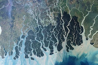
The undecided edge between land and water teems with life.  Wetlands and marshes, reefs and mangrove forests, estuaries and tidal flats demonstrate the physical result of ebb and flow.  They embody the indeterminacy of the physical status between liquid and solid, dissolving into vapor on foggy mornings.  Productive ribbons along coastlines create shadow nurseries for finfish and crustaceans, filter suspended material, stabilize and trap sediment, and assimilate dissolved nutrients.  The living plants here are unusual species, halophytes, which thrive in salty conditions; botanical amphibians that can survive choking mud and desiccating heat to naturally break storm surge and absorb wave action. 

Coastal wetlands are bioshields for the continental edge. Marshes and maritime forests protect coastal development and infrastructure from hurricanes and other storm surges. Where they do not exist, such as in south Florida, property damage caused by storms is much more devastating than in Louisiana, where a buffer of coastal wetlands separates cities from the Gulf of Mexico. “By serving as a buffer to destructive marine forces and the episodic impact of storms, Louisiana’s coastal wetlands help to protect the vast infrastructure of nationally significant oil and gas facilities.”  The marshes protect other infrastructure, too, such as roads - and more than 400 million tons of water-borne cargo, including ten federal navigation channels that provide access to port facilities handling 25% of U.S. exports.  

Most threats to the wetlands seem like a personal challenge to continued occupation.  A New York Times article explored the barrier islands of North Carolina, and the changes due to rising sea levels – 7” in the last 100 years, with an additional 2’-3’ rise by 2100 – and the communities affected by coastal erosion.  “Dr. Riggs predicted, major storms will turn many parts of the Banks into underwater shoals or flats that are above water only at low tide. If Highway 12 were abandoned and the islands allowed to find their natural equilibrium, he writes, the resulting villages would be ‘situated like a string of pearls on a vast network of inlet and shoal environments.’”[i]  Loss of the connecting roadways would lead to isolation, accelerating decay, and the abandonment of the community, first by the hundreds of thousands of tourists each year, and then by the inhabitants.

It is a constant battle against the sea to postpone but never halt completely the shifts along the edge.  The constant toil of dredging and beach renourishment, of building levees, breakwaters, seawalls, groins, piers, jetties, and dunes signify the impermanent quality of the line between water and land.  With the added pressure of climate change, chances of erosion and flooding increases.

One way to respond to the threat of rising waters is to plan now for their eventual extent by creating space along the coastlines for water to occupy. “Immediately after the tsunami (in 2004), the Sri Lanka government through its Coast Conservation Advisory Council declared a conservation buffer zone along 1,000 kilometers of coastline prohibiting rebuilding and new construction.  The buffer varied in width: in the south it was 100 meters and along the east coast it was 200 meters.  Many viewed the ban, an attempt to safeguard the country from future flooding disasters, as a government land grab to promote the lucrative tourism trade.  The resulting public outcry ultimately caused officials to relax the blanket post-tsunami ban; it is now 15 to 40 meters.”[ii]

Managed retreat from the coastal edge was a topic during the post-Katrina political discussions, but was abandoned faster than a flooding building.  The result illustrated a linear park at the western edge of Mississippi, a green buffer with boardwalks and bayous at the lowest lands on the coast, and an extension of the already-protected cheniers and marshes stretching to the Pearl River which forms the dividing line with Louisiana.  But residents were not ready to hear that their beachfront lots were the target of a buy-out program to avoid future government flood program payments… and communities didn’t look forward to the loss of the highest property tax dollars, plus the prospect of inheriting maintenance on the empty lots.  (The program proceeds quietly and voluntarily, the impetus fueled by older people who just cannot afford the emotional and financial toll of life on the beachfront, accompanied by a sharp rise in insurance and construction costs.)

Wetlands across the globe show evidence of a system well into collapse.  In the 1600’s, the continental United States had 220 million acres of wetlands, but by 1997 there were less than half of that, a total of 105.5 million acres remaining.  Only about 5% of these wetlands are along coastlines; the remaining 95% are inland marshes, meadows, forests, and swamps.  

At inland locations, most floods come from the clouds above.  Planning space for stormwater runoff is the reasoning behind requirements for retention ponds as an alternative to structured drainage, but most examples fail to contribute to the aesthetics of the community, or to ecological functioning.  Ringed with chain link, home to invasive species and windblown litter, retention ponds at the edge of big-box parking lots may provide space for water to infiltrate, but they certainly don’t come close to replicating authentic wetlands, which (along with tropical rain forests) are among the most biologically productive habitats on earth, supporting nearly 200 species of amphibians, 5,000 plant species, one-third of all native bird species, and a similar diversity of plant life.

After devastating spring floods in 2011, people along the Mississippi River better understand the value of wetlands as flood control.  Because of the loss of wetland areas for catchment and percolation, damage to buildings, infrastructure, and industries along the river banks was estimated at $6 to 9 billion.  The bottomland hardwoods and wetlands along the river could store at least 60 days of floodwater in the early 19th century, but can now store only 12 days of floodwater.  This loss of capacity led to dramatic rises along the hard-edged river, with more episodes expected in the future.

Drainage woes plague many towns, especially in flat areas, coastal plains, or valleys threatened by flooding.  Storm drainage, whether surface or subsurface, must handle the overflow and keep water moving to safe discharge areas.  Constructed culverts and drains are durable, but also susceptible to obstruction.  Surface drainage, such as swales, filter non-point source pollutants and handle higher capacities during significant rainfall. 

Water plazas in cities are the newest idea for creating a multi-functional open space to be used as a park, a grassy field, a stepped amphitheatre, playground, skate park or labyrinth in fine weather; giant catchment areas, mega-sponges, when the rains arrive.  Rotterdam, a city where the elevation is below sea level, is flirting with the idea.  No single catchment area is big enough – even Central Park cannot drain New York City alone.  A system of smaller units, spread across neighborhoods and linked, will help to offset the accelerated and intensified stormwater in cities.

The solution may be as simple as replacing structures with soils.  Not to form dead-end canals which lead water into sites, but to create more places for percolation.  Water in the city reintroduces habitat for wildlife, and provides space for children to dream, and adults to meditate.  Water, that least mysterious element of two hydrogen molecules and one of oxygen, has secret powers within the urban environment that can lead to more vibrant and congenial social spaces where neighbors talk, and adults play, and children imagine entirely different worlds. Meanwhile, the focus of all this dreaming and thinking and planning, the water silently percolates through sand and clay to the infinite cracks and fissures below, swelling the earth with fecundity once more.

Green filters are “non-structural” methods for restoring capacity along coastal edges and within cities to handle the increasing demands of storm waters: storm surge, flood, excessive rain, tidal flow, and sea level rise.  Creating green buffer zones allows water to safely pool before affecting the lives and works of man.  Until recently, wetlands were seen as wastelands.  Their productivity remained unmeasured – they occupied the undervalued edges, the barriers to contiguous development patterns, and the places of last resort for the poor and the latecomers to the urban environment.  The pressures of low densities and high population growth have nudged growth ever outward, knocking down the mangrove forests and bottomland hardwoods, filling estuaries with concrete and asphalt.

Wetlands are critical to humans’ continued occupation of the fragile edges between land and water.  They endure the most extreme conditions of flux, and provide greater value (by diverting, filtering, recharging, and evaporating stormwater) than much of the grey infrastructure which underpins cities.  Wetlands may be the most valuable lands on earth, without a single “improvement” made by man.  Man should not build with permanence on their indeterminate ground. 


[i] “A Lifeline Built on Shifting Sands.”  Cornelia Dean, New York Times, 5 March 2012.
[ii] “Lessons from Sri Lanka” in Birch, 247.